Effective water stewardship demands a holistic approach to managing water resources, particularly at the catchment scale. Catchments are complex systems where surface water and groundwater interact dynamically, influencing water availability, quality, and ecosystem health. Assessing these interactions is critical for sustainable water management, especially in regions affected by mining, agriculture, and urban development. However, traditional approaches often focus on surface water or groundwater in isolation, resulting in incomplete assessments and less effective management strategies.
Integrated surface water–groundwater modelling bridges this gap by providing a comprehensive framework to simulate how the two systems interact. This approach improves understanding of how changes in one domain such as altered land use or topography affecting surface runoff— can influence the other, including groundwater recharge or discharge. For instance, mining activities can significantly modify topography, land cover, and drainage networks, leading to shifts in streamflow, evapotranspiration, and groundwater dynamics. Without an integrated model, these impacts may be underestimated or overlooked, leading to inadequate design decisions.
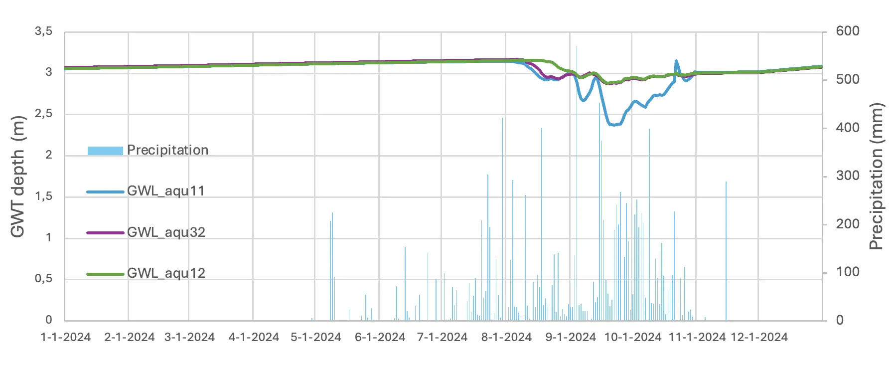
At a bauxite mine in Guinea, SRK successfully applied the SWAT+ hydrological model to better understand surface water-groundwater interactions and establish baseline conditions across the catchment. Using land use, soil, topography, and climate data as input, the model simulated streamflow, groundwater recharge, and evapotranspiration under both current and post-mining scenarios. SWAT+ revealed how mining activities, such as excavation and pond formation, altered hydrological processes, reducing streamflow while increasing aquifer recharge in some areas. These findings guided the development of targeted mitigation measures, including rehabilitating mined areas, installing sediment control structures, and implementing progressive site rehabilitation to minimize adverse impacts on water resources, quality and ecosystems.
SWAT+ has proven valuable for simulating and understanding baseline conditions and for predicting hydrological impacts of mining activities. By integrating surface water and groundwater processes, the model supports more accurate predictions of water availability and quality, helping ensure sustainable water management practices and regulatory compliance. These insights benefit not only mining operations but also the surrounding communities, industries, and ecosystems.
The importance of integrated modelling extends beyond mining to applications in agriculture, urban planning, and climate change adaptation. As water resources face growing pressures from human activities and environmental change, tools like SWAT+ provide a robust foundation for informed decision-making. By adopting integrated surface water–groundwater modelling, stakeholders can ensure that water stewardship efforts remain effective, equitable, and sustainable across entire catchment.